Aqua Map Boating

Aqua Map Boating

By GEC s.r.l.

  • Category: Navigation
  • Release Date: 2014-10-15
  • Current Version: 41.6
  • Adult Rating: 4+
  • File Size: 157.68 MB
  • Developer: GEC s.r.l.
  • Compatibility: Requires iOS 13.0 or later.
Score: 4.7
4.71969
From 10,517 Ratings

Description

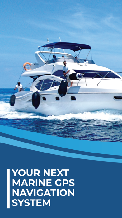
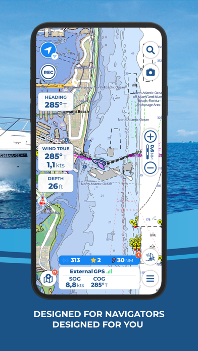
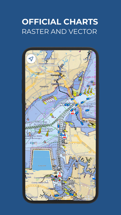
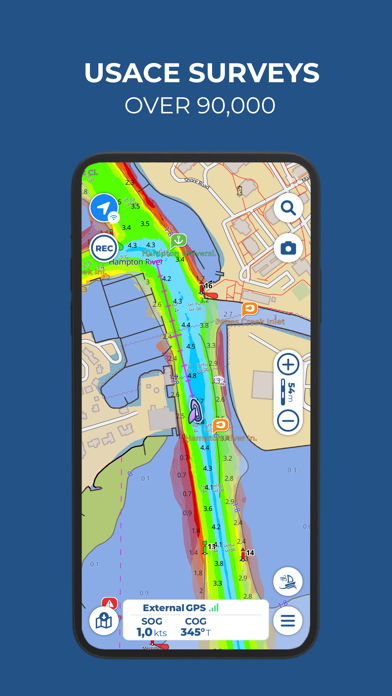
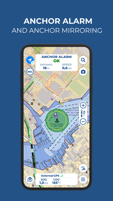
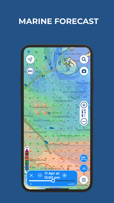
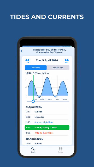
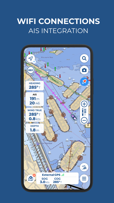
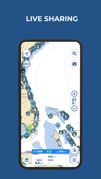
Free 14-day trial for all subscriptions   Aqua Map offers weekly updated OFFICIAL NAUTICAL CHARTS (NOAA) for marine navigation. Purchase a chart subscription for the area of your interest, download the map areas for offline use, and connect your onboard instruments for a complete experience.   ● BASIC FEATURES - Overlay satellite images on the charts - Manually create your route and record your track - Store and share your navigation data (markers, routes, and recorded tracks) - Display tides and currents predictions and simulations - Increase your safety with Anchor Alarm - Enable Live Sharing to interact with the Aqua Map community - Display points of interest from the "ActiveCaptain" and "Waterway Guide" communities ● EXPERT SUBSCRIPTION Note: this subscription does not include charts; it must be paired with a chart subscription. - Marine forecasts (wind, waves, currents, gusts, salinity, sea surface temperature + weather information for any point on the map) - Advanced AnchorLink with anchorage mirroring and email/telegram notifications for greater peace of mind while anchored, even if you are away from the boat - Connect your NMEA instruments via WiFi (autopilot, depth sounder, wind sensor, compass, GPS) and use their data on the app - AIS with automatic collision detection - Route Explorer for real-time information on all elements along your route ● MASTER SUBSCRIPTION FOR THE BEST NAVIGATION EXPERIENCE Note: this subscription does not include charts; it must be paired with a chart subscription. - All features of the EXPERT subscription are included in the MASTER subscription. - U.S. LOCAL DATA: > U.S. Army Corps of Engineers surveys for safe navigation in shallow waters > U.S. Coast Guard lights list and local notice to mariners   ● PURCHASE OPTIONS To access the charts, you need to purchase a chart subscription for the area of interest. Optionally, you can add the Expert subscription or the Master subscription to unlock extra navigation features and additional data. Subscription payments will be made through your account (Apple ID). The annual subscription will automatically renew unless canceled at least 24 hours before expiration. You can manage your subscription and disable automatic renewal in the account settings section after purchase. Terms of use: https://www.aquamap.app/terms-and-conditions Privacy policy: https://www.aquamap.app/privacy-policy

Screenshots

Reviews

  • Review

    1
    By mr boater
    This does me no good
  • Route

    1
    By MSMYachts
    It’s not practical, I couldn’t setup a router.
  • Great Navigation App and Cruising Guide

    5
    By Parke Brinkley
    I use Aqua Map master version extensively for navigation and exploring. The available overlays include the Waterway Guide and Active Captain suggested anchorages, and also the most recent Army Corps of Engineers depth survey info (overlaid on the charts), which is of HUGE help when navigating the Intracoastal Waterway and nearby inlets.
  • Too money hungry

    1
    By Michigan Outdoorsman
    They charge too much and are too money hungry.
  • A Top Notch App

    5
    By 7-6 & Bo Pilot
    I am cruising the Great Loop in sections in a 2012 Ranger Tug R27. The chartplotter on my boat is a legacy Garmin 5212. I use the chart plotter for a radar and sonar display and navigate with Aqua Maps on an iPad Pro 12.9”. For redundancy, I carry two iPad Pros. Aqua Maps is well thought out and continuous improvements are made. It is easy to use and information is easy to access. Charts are easy to select, download and update. The developers respond quickly to email support inquiries. I highly recommend this application.
  • Better than on-boat plotters

    5
    By Exivus
    Just like ForeFlight is a modern necessity for flying, this is THE app for boating. Hope it NEVER changes!!
  • Another nickel and dime to death app

    1
    By captain AppleBoy
    I absolutely loathe being nickel and dimed, and I hate this modern paradigm of “subscription“ every goddamned thing. I may not sail for two years, but when I go out I want the CHARTS and MAPS to still be charts and maps, not some scrambled data that’s unusable until I throw more money at a company that may not even exist at that point. AAARGH! I love the companies that give us the option to just BUY something, and OWN it. This program does not appear to be one of those. If I’m wrong, and the option to BUY this exists somewhere, I will come back and re-review.
  • tap and download updates

    4
    By msw611
    I am not crazy about how you tap and download updates on the tiles anymore. I prefer the old way.
  • Kept us safe!!!

    5
    By Dsmrossi
    I’ve had Aquamap for many years now. Went on a fishing trip off the coast of Block Island last night with my buddies. While the water was flat, we were in THICK fog all night. We used the app to get home in conditions boats loaded with electronics didn’t venture out in. We wouldn’t have made it in otherwise. The currents were moving FAST and pushing the bow all over the place. Being able to plot our heading and make continuous adjustments was critical. Only thing - and it may just be my phone - is that if you stop for a bit it doesn’t immediately register where your bow it pointed, you need to get going approx 10kts or so before you get an accurate “pointer”. Thank you!!!
  • Download

    4
    By RapidStang
    I have learned that there is a way to control the timing of the tile downloads. If you are getting interrupted by this, there’s a way to adjust the timing of downloads in Sertings, what a great app.!

keyboard_arrow_up